
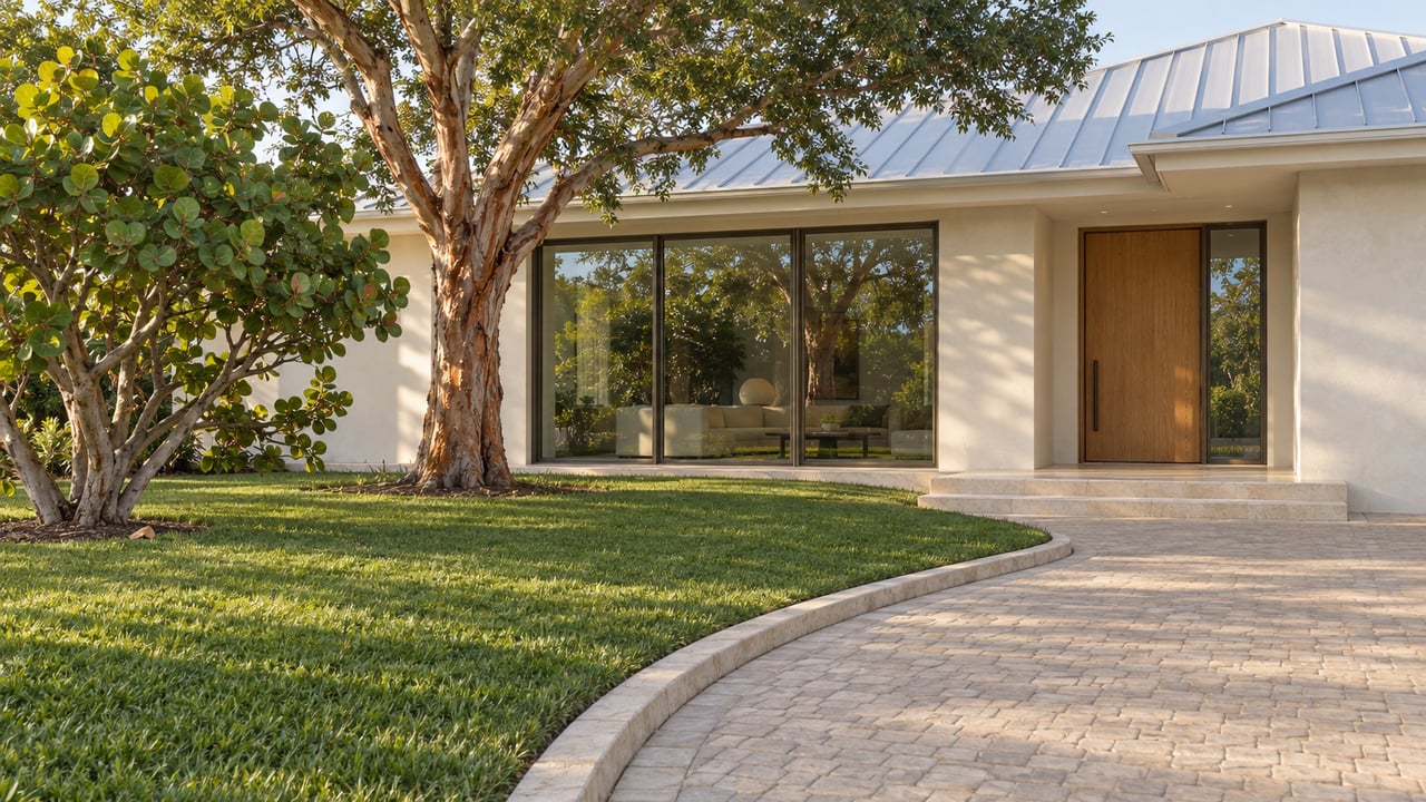
"To be able to see the bodies of water connect there is really special," Council Member Malise Sundstrom said on January 20, just before the Town Council approved the Suni Sands settlement on a 4-1 vote, as Stet News reported. She meant the spot where the Loxahatchee and Indian rivers meet at the mouth of the Jupiter Inlet. You can see it from the Lighthouse, looking across the water at a former mobile home park that, by Stet's account, has been closed to the public for more than 120 years.
At 6 p.m. Thursday, October 29, the Town Council holds the first reading of the "Sperry" plan for that land at 961 and 997 North A1A. The plan calls for a hotel, residential condominiums, a restaurant, retail and a marina. The decision will take more than one hearing. For people who live here, what it settles comes down to how many feet of Inlet shoreline the public will be able to walk, and on what terms.
The site covers about 10.5 acres north of North A1A and east of Clemons Street, in the Inlet Village part of the Town's US-1 Intracoastal Waterway Corridor. The Town's September 3 staff report lists what stands there today: a commercial building with Blueline and Cones and Coffee, a parking lot, an apartment building, some accessory structures and an existing dock.
The same report places the site among familiar Inlet Village neighbors. Baron's Landing Motel, Guanabanas and Inlet Village Marina sit to the south, Jupiter Inlet Condos to the east, and Castaways and Schooners to the west. The water to the north is the Jupiter Inlet, where the Indian River Lagoon meets the Loxahatchee River estuary.
The ground itself carries history. It holds the Suni Sands shell midden, which Stet News describes as the place where the Jeaga and Jobe peoples lived 5,000 years ago. It also holds the northern end of the Celestial Railway, the line that ran across the property from 1889 until 1895 and met boats carrying passengers and cargo at the Inlet. Those features shaped the settlement, and the settlement now shapes what reaches the Council.
Three items go before the Council together, according to Jupiter News Now: a land use change, a zoning text change and the planned unit development itself. The land use change is where the public shoreline gets decided. The table sets today's designation beside what the owners asked for and what the Planning and Zoning Commission recommended on September 10.
| Today | Owners' request | P&Z recommendation, 7-0 | |
|---|---|---|---|
| Developable land | 1.8 acres Riverwalk Flex, 8.7 acres High Density Residential | 5.0 acres Inlet Village Flex | 4.3 acres Inlet Village Flex |
| Conservation | None | 5.5 acres | 6.2 acres |
| Riverwalk corridor | 535 feet | 142 feet | 535 feet |
The extra 0.7 acre in the Commission's version is a strip along the shoreline, moved out of the developable area and into Conservation. A motion to recommend the owners' version first was made and failed for lack of a second.
The Riverwalk row matters most to anyone who walks the waterfront. Jupiter News Now reports that the Riverwalk was planned to run along this shore to the historic Sperry boathouse, which came down in 2016 after hurricane damage. The owners want the corridor to end near the dock at the northwest corner. That cuts 393 feet. Town staff called the change a "policy decision of the Town Council" and noted that it would drop the requirement for future public access along part of the waterfront.
The request would also lower the maximum number of homes the site could hold from 73 to 59. Most of that drop comes from the land set aside for Conservation.
The Riverwalk corridor is one piece of public access. The other is a park the settlement would create. Under the terms reported by Stet News, if the Town approves the owner's plans by December 31, the Town receives the 4.07-acre midden and a railway strip 950 feet long and 9.5 feet wide. It would also buy 1.41 acres in the northwest corner for $10.5 million, a price both sides described as a deep discount. That corner was the Town's first commercial hub. Use of it would be limited to a passive park, and as of January the Town still had to work out how to pay for it.
The owners' shorter corridor would end near the northwest dock, close to that corner park. The Commission's full-length corridor would keep the requirement for public access along more of the waterfront toward the old boathouse site. Either way, a resident's actual waterfront access depends on the corridor and the park together.
The terms of the park are still being worked out. In August, WFLX reported that Town Attorney Thomas Baird told the Council the developer was seeking restrictions on the Town's future park land. Baird described those restrictions as "Limit the activities that could occur in the park, limit the hours of the park." The developer's attorney told WFLX that his client is fully compliant with the mediated settlement.
Stet News reported that the settlement describes the owner's interest in a dock on the Inlet near the former Sperry boathouse. Vice Mayor Ron Delaney cast the one vote against the settlement. Stet reported that he wanted the Town's preserved land to include the entire waterfront, and that he had concerns about a dock's effect on sensitive seagrass.
The Jupiter Inlet Foundation has raised the same concern. Speaking to WFLX, Foundation member Cameron May pointed to a buoy marking Johnson seagrass, which he described as a threatened species and an important food source for manatees. The developer's attorney told WFLX the project would bring substantial improvements to the environment offshore.
The Town's hearing notices give no number of marina slips, hotel rooms, condo units or building heights. For comparison, Stet News reported that the owner's 2023 proposal called for a 125-room inn, 72 townhomes and condos, and about 12,000 square feet of restaurants and stores. In January, the owner's attorney said the new application would be similar to that original proposal.
The Town wants North A1A to stay a two-lane road through Inlet Village, and traffic puts a ceiling on whatever goes on the developable land. Table 2 of the staff report, as summarized by Jupiter News Now, compares the site's maximum car trips under each scenario:
The applicant's traffic study found that nearby roads meet Town standards through 2045. Staff said the request could still exceed the Town's goal for A1A and recommended a cap on trips. Staff found the land use change generally consistent with the Comprehensive Plan only if a trip cap covers the Inlet Village Flex acreage. The Commission's 7-0 recommendation asked the Council to consider traffic mitigation and an "equitable trip cap."
A trip cap and a Conservation strip along the shoreline work toward the same result. Each limits how much activity the developable acres can hold, and each helps decide how much of the Inlet edge stays open to the public.
Thursday's meeting is a first reading. It does not settle the matter. The steps, as the Town and the settlement lay them out:
The Town posts agendas and supporting documents on its Agendas and Minutes page, usually about a week before a meeting. The hearing notice names planner Peter Meyer in the Planning and Zoning Department, 561-741-2691, as the contact for questions. The site plan arrives with the second reading, and it will be the first public document to show where the corridor and the park would actually meet the water.
If you own near Inlet Village or are weighing a property along the Loxahatchee, Malloy Home Team is glad to talk through what this plan could mean for your stretch of the water. Schedule a consultation whenever it suits you.


In a market where presentation, strategy, and relationships define outcomes, choosing the right team isn’t optional, it’s everything. At the Malloy Home Team at SERHANT., we don’t just list homes. We position them. We don’t just find properties. We secure opportunities others never see.

114 N Coastal Way Jupiter, FL 33477